01 / CONTEXT
The purpose
Help people explore climate risks and report hazards through location-based information on mobile devices.
02 / THE WORK
Inside the project
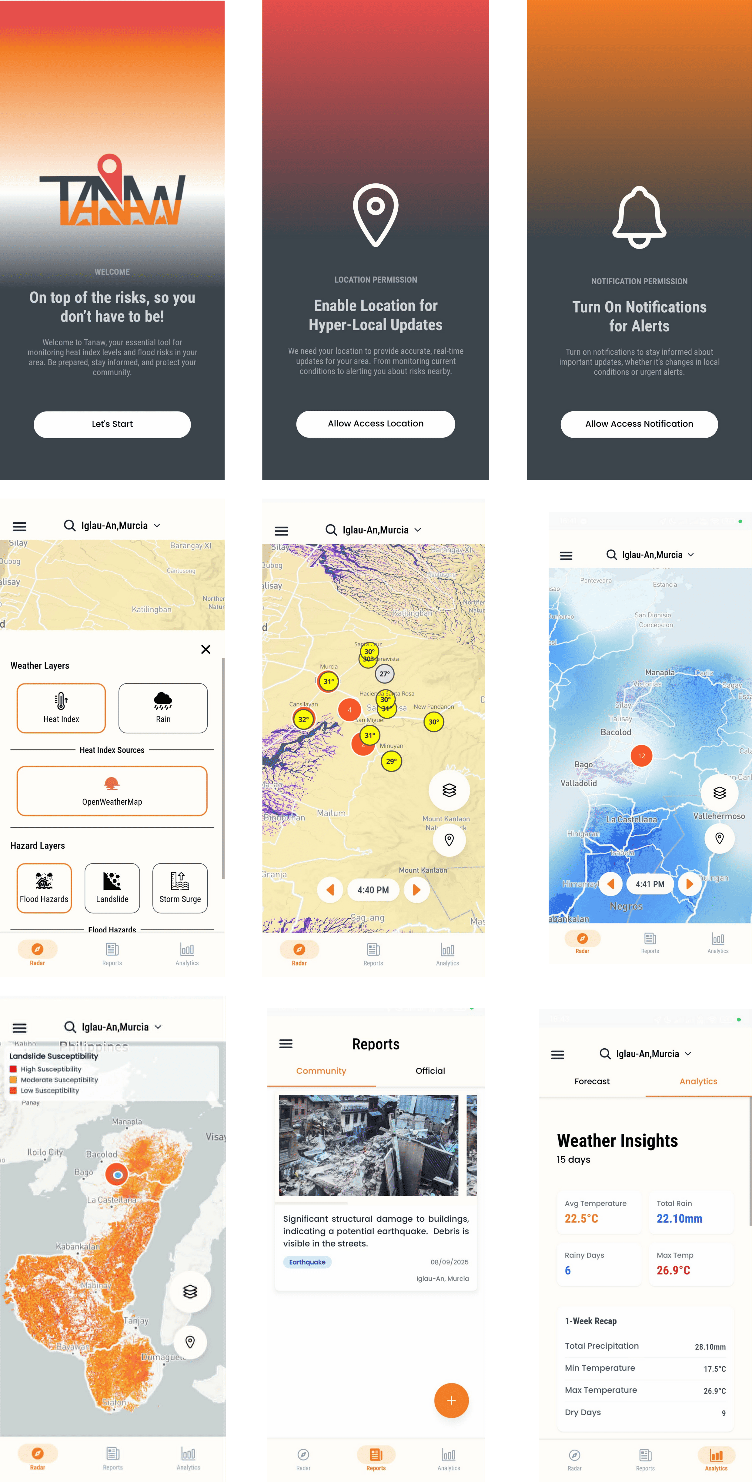
I developed TANAW during 2025 as a mobile application for climate-risk visualization using real-time geospatial data. React Native and Expo provide the mobile foundation, with Supabase supporting backend services.
My work included location-based mapping, live data updates, and a modular architecture for real-time hazard reporting and future feature expansion. AI-assisted reporting supports the organization of user-submitted incident information.
The project brings mapping, environmental information, and reporting into a connected mobile experience. Open the project or source to explore its interface and implementation.
03 / TAKE A CLOSER LOOK
Explore the work
Review the available application and implementation, then get in touch to discuss the project in more detail.